
What to expect from a La Niña summer
School's out, the borders are re-opening and many of us are looking forward to hitting the road to visit friends and family, days at the beach and exploring the great outdoors – but is La Niña going to play nice?

Her name translates to “little girl” in Spanish, but there is general agreement that this weather system can be a somewhat unpredictable child. And she has already given us a taste of what to expect this summer.
“La Niña has shown that she can be anything but innocent,” says Professor Claudia Baldwin, co-director of the University of the Sunshine Coast’s Sustainability Research Centre.
“Having brought heavier rains and flooding to Canada and the US over the past months, she is now starting to reveal herself in heavier rainfall and flooding in Queensland.
“This summer, we have perfect conditions – as we have already seen – for hurricanes in the northern hemisphere, and cyclones in the South Pacific and Australia, as temperatures build up over summer.”
Understanding La Niña
"My advice is to keep an umbrella handy, make the most of sunny beach days when you can – and remember, ‘if it’s flooded, forget it'."
Dr Adrian McCallum


Dr Adrian McCallum, who lectures in weather and climate at USC, says La Niña is an atmospheric and oceanic phenomenon in the Pacific Ocean that can affect the weather worldwide. She is the opposite phenomenon to El Niño (Spanish for “boy-child”); El Niño typically brings drought to Australia.
“During a La Niña event, the westerly trade winds that blow along the equator in the Pacific Ocean strengthen and more warm water is pushed towards Asia from South America,” Dr McCallum says.
“These warmer waters to the north of Australia tend to result in increased cloudiness and more rainfall than average, from north-western Australia to the south-east because convection in the atmosphere is enhanced.”
After experiencing the hottest November on record in Australia, the good news is that we can expect generally cooler days during a La Niña event.
But the trade-off is hot summer nights, with warmer overnight temperatures. Also expect more cloudy and rainy days accompanied by sticky, high humidity.
“Generally, there is also the increased risks of extreme weather, including floods and cyclones. However, the forecast by the Bureau of Meteorology is that this La Niña will be short-lived and weak to moderate in strength.
“Keep in mind, though – as the Bureau notes – the strength of an event doesn't necessarily equal the strength of its effect.”
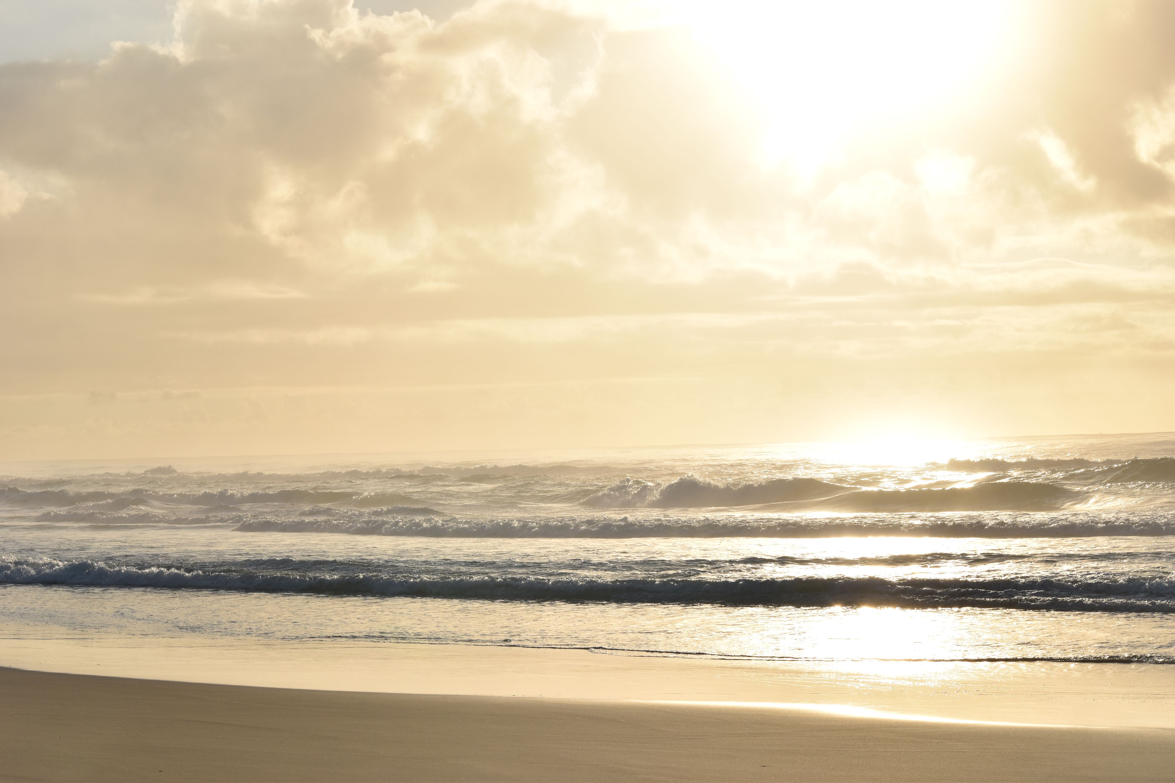
Surf's Up!
La Niña’s arrival is good news for surfers this summer, but it has the potential to be not so great for our beaches.
USC geographer Dr Javier Leon says La Niña rotates waves anticlockwise, which means an increase in waves approaching from the north-east and east, which can create great surfing conditions along the south-east coast.
“The flip side is that La Niña increases the chances of cyclones. Combined with underlying warmer waters due to climate change, this might mean that stronger cyclones could travel to southern locations, such as the Sunshine Coast.
“This would also increase coastal hazards such as erosion and flooding.
“But even without cyclones, the wave rotation associated with La Niña could exacerbate sediment movement and eventually increase erosion of otherwise protected north-facing beaches.”
These could include Main Beach Noosa, Mooloolaba, Byron Bay, Coolangatta, North Stradbroke Island, Kings Beach, Double Island and Agnes Water.
Dr Leon says a La Niña also rises sea levels, up to 10-20 cm around this side of the Pacific.
"That adds an extra layer to the already increased erosion and flooding hazards."


Feeling the heat
Best not to get too hopeful about La Niña’s reputation for cooler daytime temperatures. Put into context, it will still be one long, hot summer.

“Heat waves are expected to increase in frequency and last longer.”
Professor Baldwin says extreme heat will be a challenge with more frequent hot days and significant increases in record temperatures – the result of a changing climate where average temperatures in Queensland have increased by approximately 1°C over the past 100 years.
“A characteristic of heatwaves is that the night-time temperature does not decrease by much, offering little relief,” she said.
“In South East Queensland, heatwaves are expected to increase by approximately seven days per year, and in Far North Queensland by 10 days by 2050.
“This is intensified in cities through the heat island effect, where hot air reflects off impermeable surfaces and is trapped among denser buildings.
“In coastal areas in Queensland, high humidity levels will compound the perceived temperatures and level of human discomfort.”
Heatwaves have killed more Australians than road accidents, fires, floods and all other natural disasters combined.
The dangers of heat stress from extreme heat events should not be underestimated.


“Among those most vulnerable to heat stress are seniors, babies, people with disabilities and others who have less means of regulating their environment."
“Extreme heat disproportionately affects seniors because they generally have higher health burdens. It discourages physical activity, which in turn is a health risk.”
Finding ways to mitigate the impacts of heat using ‘green infrastructure’ is a major focus of research by Dr Baldwin and her team at USC’s Sustainability Research Centre.
One project involves developing a model heat adaptation plan for aged-care facilities in Queensland, using natural features where possible to reduce heat.
And the findings could have lessons for us all when it comes to reducing ambient heat and improving air circulation in our own backyards and houses.
Holiday project anyone?
Steps to reduce heat include:
- replacing lawn with native vegetation and grasses
- installing shade structures over paths
- planting trees, flowering shrubs, ground covers
- replacing gravel with organic mulch
- using reflective roofs and solar panels and introducing green walls, permeable surfaces and rain gardens that filter air and water
If you need convincing, Dr Baldwin says just look at the image below.


“We placed weather sensors around each facility to find the hottest spots and supplemented this heat measurement with thermal cameras, which provide a good illustration of hotter materials. Note the hot path and wall compared to the grass on the left – a good demonstration for non-believers!”


The 'Little Girl' has form
“Floods are extremely hard to predict and no two floods – or La Niña years – are the same.”
“History shows us that La Niña years are more likely to be wet, the likelihood of floods and cyclones more common, but it is no guarantee of a major flood,” says USC History academic Dr Margaret Cook who specialises in the history of natural disasters in Australia and New Zealand.
That said, La Niña has certainly made her presence felt during some of the worst floods in Queensland’s history.
One of the strongest La Niña events to date was during the summer of 2010/20111, when most the whole of Queensland experienced widespread, devastating flooding. The combined rainfalls resulted in the wettest 24 months on record 2, and impacted more than 90 communities across the state.
“In the La Niña year of 1893, more than 1000mm fell in Central Brisbane within one fortnight in February,” Dr Cook said. “To provide perspective, Brisbane’s mean rainfall for February is 158.3mm.”
That same year, the Mary River also flooded Gympie, Maryborough and Bundaberg. “Gympie had its highest flood to date, reported as being 24m higher than normal – and the Bundaberg wharves were 2.5m under water.”
Brisbane’s second-largest flood occurred in 1974, another La Niña year – and Australia’s wettest year on record. The same weather system also swamped several other communities, including Ipswich, Maryborough and Gympie.
La Niña tends to go hand-in-hand with cyclones, with the Queensland coast experiencing three to four times as many cyclones during La Niña years as during El Niño years, Dr Cook says.
“1954 was a La Niña year and Queensland had eight cyclones, with seven hitting Bundaberg. One cyclone, unofficially known as the Great Gold Coast Cyclone, caused damage form Noosa to Lismore.
“The La Niña year of 1974 brought perhaps Australia’s best-known cyclone, Tracy, that destroyed Darwin.
“The 1973–74 cyclone season was the third-most active tropical cyclone season recorded in Australia, and included Cyclone Pam, that damaged the Sunshine Coast.
“Cyclone Yasi in 2011 was a Category 5, and it occurred in a La Niña year, adding it to the list of the seven largest cyclones in Queensland. That year, Queensland experienced 11 cyclones, which followed on the heels of Cyclone Tasha at the end of 2010.”
Despite her reputation for bringing destruction and disruption, La Niña years are not all bad news, Dr Cook says.
"They restore ecological systems by replenishing water systems and flushing out rivers.
"The increased rainfall fills dams and provides the water supply that Australians rely on as we live in the driest occupied continent on Earth.
“The topsoil in the floodwaters replenish agricultural land and provide bumper years for farmers.”


Uninvited guests
Could La Niña bring along some unwelcome guests who love a wet summer?
Research Fellows Dr Andy Howe and Dr Babar Hassan of USC’s Forest Industries Research Centre say the widespread and consistent rainfall associated with La Niña this spring/summer will be a gift for plants, and the insects that eat them.
“Half of Australia’s estimated 200,000 insect species are thought to be herbivorous – so La Niña’s benefits to plants will also mean lots of happy insects – but whether that means more of all insect species is not certain,” Dr Howe says.
“It is possible La Niña conditions might add a little more bite to your outdoor entertaining this summer, especially if numbers of the saltmarsh mosquito, the freshwater-breeding mosquito or the container-breeding mosquito boom in your area.
“Homeowners can do their bit towards controlling mosquitoes by maintaining water tanks and regularly emptying stagnant water in bird baths, pot plant saucers and other outdoor water vessels to disrupt their life cycle.”
Similarly, termites love the warm and humid conditions prevalent during La Niña summers.
Dr Hassan says these conditions transfer moisture from the atmosphere to timber structures, which could increase wood moisture to levels suitable for termite attack.
“Keep an eye out for emerging termite swarmers (winged, reproductive termites) after rain. People may notice piles of termite wings on the floor underneath light fittings – this is a sign that termites are moving about trying to establish new colonies.”
Some insects you might be happier to see are Australia’s much-loved Christmas beetles that enjoy spring and summer rains which soften the ground for pupating larvae and enable adults to dig themselves free.
“Adults feed on eucalypts, which will benefit from La Nina rains,” Dr Howe says.
“Similarly, climate and habitat modelling of a few Australian butterfly species has shown that La Niña conditions can benefit butterfly habitat quality – so we hope to see plenty of butterflies over the summer.”3
Dr Howe suggests keeping an eye out for insects this summer, snapping some photos and uploading them to the iNaturalist website to share with other nature enthusiasts.
References:
1.http://www.bom.gov.au/climate/enso/history/La-Nina-2010-12.pdf
2.http://www.bom.gov.au/climate/history/enso/
3.https://onlinelibrary.wiley.com/doi/10.1111/btp.12356


